
Ground Penetrating Radar (GPR)

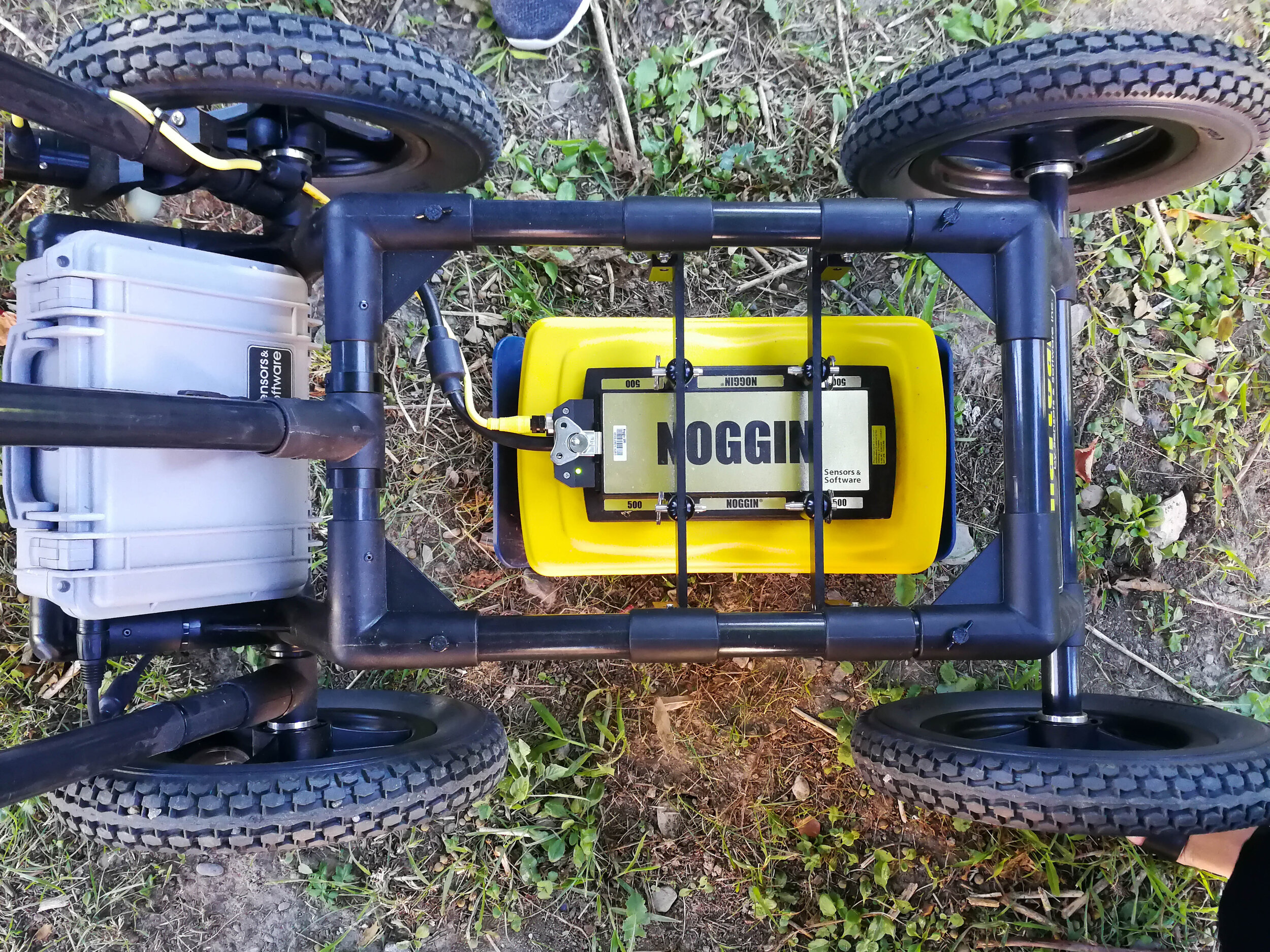
Ground Penetrating Radar (GPR) is an effective, non-invasive tool to scan the ground for buried objects. Our Noggin 250 MHz is equipped with a durable SmartCart, which allows us to provide rapid data collection in open areas.
An important component of GPR surveys is accuracy; and, therefore, we have equipped our SmartCart with a Global Positioning System (GPS) for the most accurate results.
The Noggin 250 MHz SmartCart GPR is also equipped with a Digital Video Logger (DVL). The DVL allows the user to read live GPR data and detect anomalies while completing the Project, which is ideal for locating buried utilities (power, water lines, sewer lines, pipelines), buried tanks, valves and manholes.
For more sensitive Projects (detecting unmarked graves, forensics), and depending on soil type, GPR data often has to be further analyzed using specialized GPR software (EKKO Software). GPR is an effective tool to identify voids in roadways (highways, parking lots), landfills (extent of buried garbage) and can also measure ice thickness (ice roads), resource exploration (peat deposit thickness) and sediment accumulation in waterbodies (lakes, ponds).
For more specialized Projects, Prairie Mapping Industries has access to specialized GPR equipment and antennas to meet the needs of the subsurface investigations.
GPR surveys are quick and effective solutions to identify buried objects and voids to assist property owners, land developers, urban and rural municipalities, engineering firms, environmental consultants, archaeologists, construction companies, Crown corporations and the RCMP.
GPR surveys provide a non-invasive and cost-effective approach (zero ground disturbance) to subsurface ground inspection.

Cemetery Management

Prairie Mapping Industries believes cemeteries are an important part of our history.
Cemetery management is crucial to preserving our history, commemorating our ancestors, and planning for future interments and cemetery use. When properly managed and commemorated, cemeteries can provide a sense of pride within communities, Rural Municipalities and local church groups.
Unfortunately, many cemeteries have no formal survey plans, poor burial records and unmarked graves, making future interments and management of the cemetery problematic.
Based on our experience in Saskatchewan, the average rural cemetery has been in use for approximately 100 years. In the early days, graves were often marked with wood crosses and rocks.
As time passes and without the continued up-keep of the grave, wood crosses rot and grave markers are eventually moved to allow for easy maintenance of the cemetery. Eventually, these graves became forgotten and unmarked.
Prairie Mapping Industries has completed several cemetery management Projects using Ground Penetrating Radar (GPR) to identify unmarked graves.
Using statistical data from the last 25 cemetery Projects, it is accurate to state that all rural cemeteries have unmarked graves. Based on our past Projects, we estimate that up to 15% of the total graves located within each cemetery are unmarked graves.
